Haiti is one of the countries with the highest risk index for natural disasters in the world and one of the highest indicators of lack of resilience in Latin America and the Caribbean. Year after year, the hurricane season arrives between June and November, generating extreme weather events including rain, strong winds, fast and slow floods, and landslides. Considering only hydrometeorological threat events (tropical cyclones, storms, tornadoes, snow storms, snowfalls, avalanches, storm surges and floods) between 1994 and 2013, Haiti was ranked as the third country with the greatest impact in terms of loss of life and economic damage. For example, there were 4 hurricanes (Fay, Gustav, Hanna and Ike) in 2008 in the span of one month. This resulted not only in the loss of human lives, wounded and affected, but also the collapse of the national transport network, causing the disconnection of different regions of the country and the inability to transport goods and food. Total losses were estimated at US (14.6% of GDP) Given this situation and considering that, according to the IPCC, climate change can generate greater and more frequent precipitation events that can cause flooding in some areas of the planet, the Haitian government requested the support of the Inter-American Development Bank (IDB) together with the European Investment Bank (EIB) for the construction and / or reinforcement of new and existing road infrastructure (roads and bridges), in which resilience to the risk of natural and climatic disasters must be guaranteed. 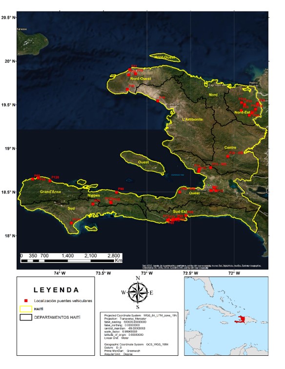
Location of 33 vehicle bridges selected for the project. Source: MTPTC (Ministère des Travaux Publics, Transports et Communications)
The construction / reinforcement program included 33 bridges located in 8 of the 10 departments of the country. Due to the hydrometeorological threats to which the country is exposed, it is considered that the program should include designs resilient to the effects of climate change for floods. In response, the IDB initiated coordination with the Transportation Division (INE / TSP), the Climate Change division (CSD / CCS) and the Water and Sanitation division (INE / WSA) to:- Integrate climate change into the hydrological model, with the aim of calculating rising hydrographs (variation of flow over time) with the influence of future projections of extreme precipitation.
- Generate flood maps for different return periods, using the HydroBID Flood
- Generate technical annexes for the geometric and structural design of vehicular bridges.
- Geometric model: geometric characteristics of the basins,
- Meteorological model: design storms associated with return periods,
- Loss model: processes of infiltration and / or evapotranspiration of the basins,
- Transformation model: transformation of volume of rain to runoff,
- Traffic model: calculation of travel time of the runoff volume to the 33 bridges.
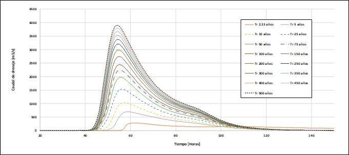
Estimated flood hydrographs for historical precipitation condition in the drainage basin of bridge 120 (Estimé river)
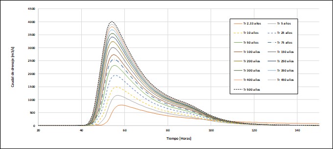
Estimated rising hydrographs for precipitation condition with climate change in the drainage basin of bridge 120 (Estimé river)
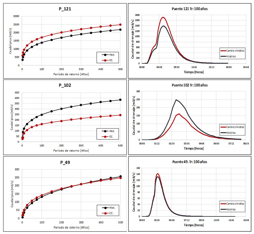
From the comparative analysis of the peak flow results between the historical and future scenario, three types of results are deduced: increase, decrease and no change. Of the total of 33 bridges, in terms of the future peak flow change in relation to the historical, 15 (45%) bridges increase their flow, 2 (6%) bridges remain unchanged and 16 (48%) bridges decrease their flow.